Find the boats that will sink — before they do.
Booker Robotics gives Florida cities, counties, marinas, and marine enforcement an objective, repeatable way to identify at-risk moored vessels early — when intervention costs a fraction of underwater salvage.
Example mooring field
| ID | VCRI score | Tier |
|---|---|---|
| V-07 | Critical | |
| V-12 | Critical | |
| V-03 | Critical | |
| V-15 | Moderate | |
| V-09 | Low |
Most derelict vessels get attention only after they sink. That's the expensive part.
Florida's laws and grant programs have improved, but they still take time to navigate once a vessel is in crisis. By then the boat is often beached or on the bottom — leaking fuel, damaging seagrass and habitat, creating navigation hazards, and costing taxpayers far more to remove.
Booker Robotics moves that decision earlier, with evidence that stands up in a staff report, a council meeting, or an owner notice.
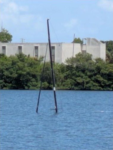
One 34-ft sailboat: $2,550 to address afloat vs. $25,500 once it's on the bottom.
Representative per-foot rates; actual costs vary by vessel, site, and contractor.
Measure every hull. Track every change.
Aerial snapshots miss slow water intrusion. We build a precise, repeatable baseline for each vessel from the water, then measure how it changes.
Baseline survey
We photograph each vessel from multiple fixed angles at surface level and log precise coordinates, creating an individual structural baseline.
Recurring observation
We return on a set schedule to capture the same angles, so small changes — a lower waterline, a new list — become measurable.
VCRI scoring
Structural, compliance, and spatial indicators roll up into one Vessel Compliance & Risk Index score for every hull, updated each cycle.
Triage report
You receive a ranked, mapped report showing which vessels need action now, which to watch, and the evidence behind each score.
One score. Three pillars of evidence.
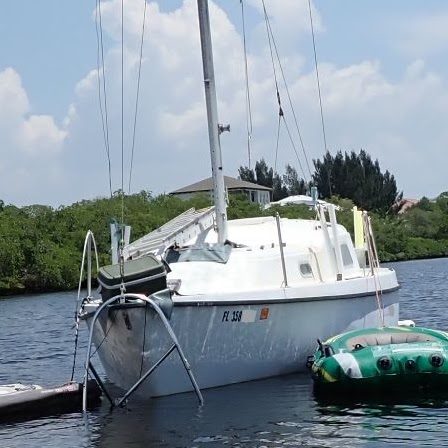
Structural integrity
Precision surface photogrammetry tracks freeboard and geometric ratios over time to signal degradation before a vessel reaches critical failure.
- Waterline and freeboard change
- Hull distortion
- List and heel angle
- Hatch and cover condition
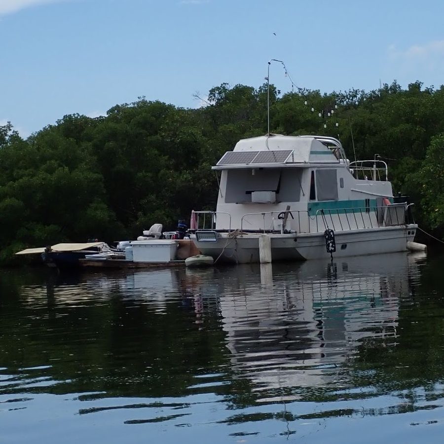
Compliance
Documenting visible compliance indicators over time creates an audit trail that separates maintained vessels from those drifting into abandonment.
- State registration decals
- Hull ID and vessel name
- Long-term anchoring permit status
- Local mooring ordinances
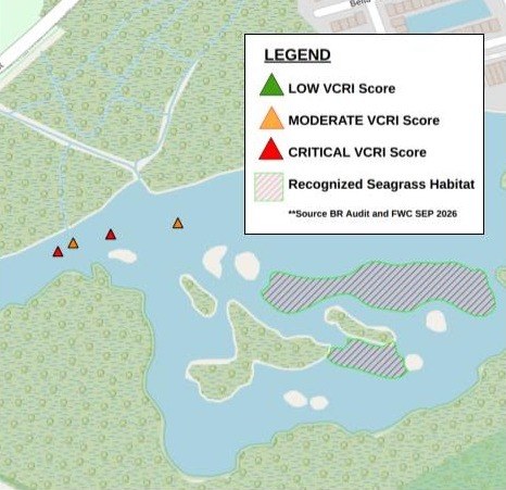
Spatial context
GPS positions capture mooring drift and movement, layered with official FWC habitat data to show what's at stake above and below the surface.
- Mooring position drift
- Proximity to seagrass and mangroves
- Navigation and channel risk
- FWC reference data
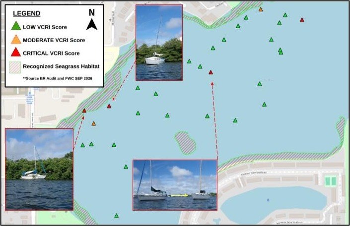
See the whole field at a glance. Act on the ones that matter.
Every reporting cycle, clients receive a scored map and ranked vessel list. This audit of 31 vessels at Big Bayou flagged four critical vessels — three that dragged anchor and an unmarked catamaran that lost about 5 inches of freeboard in two weeks.
Built for the people responsible for Florida's waterways.
Cities & counties
Prioritize limited removal budgets and document the case for early action. Since July 2026, local code enforcement can take on long-term anchoring and at-risk vessel enforcement by FWC-approved ordinance — our data supports that work.
Marinas & mooring fields
Spot neglected vessels before they damage neighboring boats, docks, or your reputation — and reach owners sooner.
Marine law enforcement
A dated, photo-backed record of visible condition and compliance to support at-risk determinations and owner notices.
Environmental agencies
See which at-risk vessels sit closest to seagrass, mangroves, and other sensitive habitat, and act before a spill.
Privacy-first by design
Built by people who grew up on these waters.
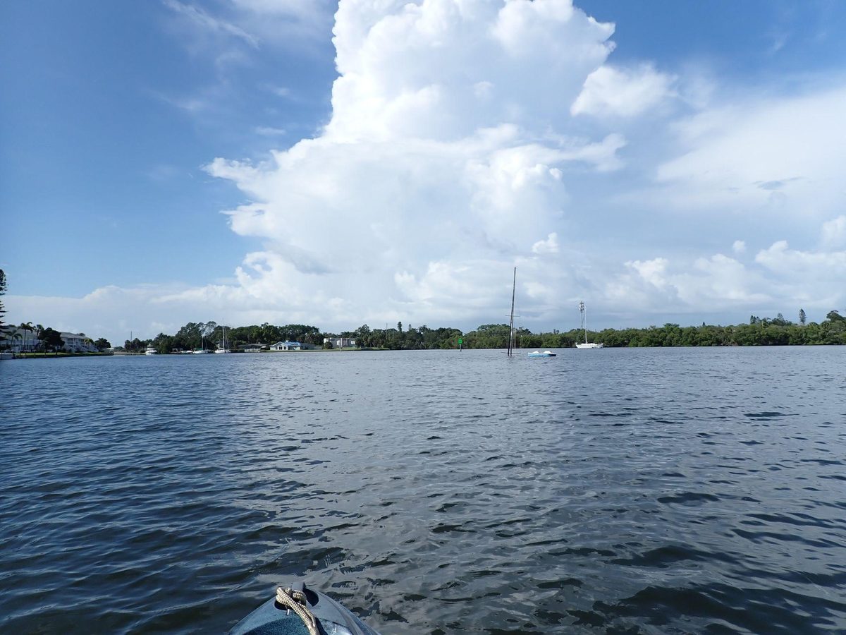
We were raised on Tampa Bay and have spent our lives watching derelict boats rot in place, year after year. We know the toll they take — environmental damage, safety hazards, strained budgets, and harm to property values and public waterways.
Waiting for a vulnerable boat to sink before acting is outdated and expensive. We built Booker Robotics to give authorities early warning and the evidence to act — at an economical cost.
Jeremy Booker
Jeremy combines years on Tampa Bay's waters with FAA-certified drone operations and geospatial analysis to turn field observations into maps and reports agencies can act on.
Launch a pilot in your waterway.
We're partnering with a small number of early-adopter cities, agencies, and marinas to deploy VCRI monitoring and tailor reporting to their workflow.
One mooring field or anchorage
3 months, with field visits every 1–2 weeks
Baseline dataset, monthly reports, and a final findings briefing
Scoped to fit your purchasing process
We deliver data formatted for your existing enforcement, grant, and reporting workflows.
Request a pilot quoteWhat agencies usually ask us.
Do you board or touch vessels?
Never. All observations are surface-level and made from publicly accessible waterways and anchorages.
How often are vessels observed?
Typically every one to two weeks, tailored to each site's risk level and budget.
Can your reports support enforcement?
Reports provide a dated, photo-backed record of visible condition and compliance. Enforcement decisions remain with FWC and local agencies.
Where do you operate?
We're based in Tampa Bay and serve waterways across the region. Contact us about other Florida locations.
Talk to us about your waterway.
Tell us about the mooring field or anchorage you're concerned about, and we'll follow up to schedule a short briefing.